Your cart is currently empty!
Fossavatnsgangan 50 km
Date
April 17, 2027
Startup
08:00–9:00
Style
Classic
Age limit
16 years
Transponder timing
Yes
Backpack requirement
Yes
Time limit
2.5 hrs for 10 km;
6,5 hrs for 35 km
Fossavatnsgangan 50 km counts as one of the four Landvættur challenge.
The course
In a nutshell
The first 15 km are tough as you work your way from 290 m altitude up to 614 m. From there you have a fairly easy 10 km descend towards Nónvatn and Engidalur, to the turning point at “Steinn” (approximately 26 km). The next 4 km are not easy and are followed by a very long and demanding climb up to Fellsháls. After that you have a long section in a gentle terrain, before the final climb up the notorious Miðfellsháls. From there, the last 7 km are all flat or downhill.
Distance between drinking stations
| Start-Búrfell | 5.2 km |
| Búrfell – Heathen | 4.5 km |
| Heiden – Nónvatn | 9.7 km |
| Nónvatn – Nónvatn | 8.3 km |
| Nónvatn – Heiden | 6.7 km |
| Heiden – Búrfell | 5.4 km |
| Búrfell - finish | 10.2 km |
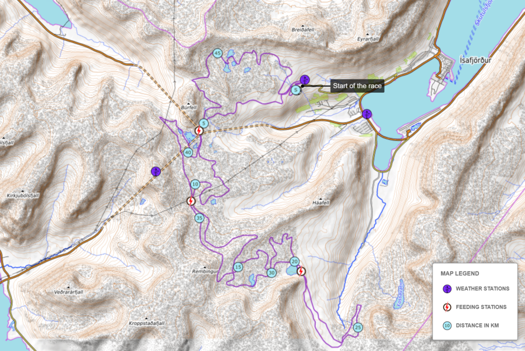
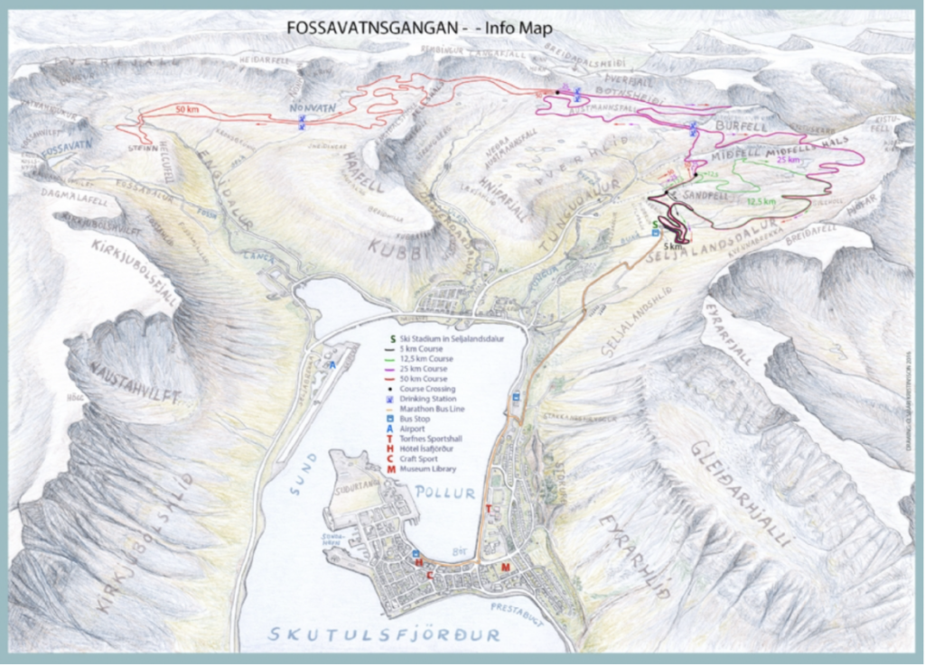
Course description
You start from the ski house at Seljalandsdalur like all the other distances. The first kilometer is an easy loop around the start area, but the next kilometer is mostly a steep and difficult climb up to Háabrún, one of the most picturesque points of the course. The view from there over the fjord Skutulsfjörður is stunning and ideal to take a photo or two if you´re not too much in a hurry.
Following the climb up to Háabrún you come to a relatively flat section that stretches for over a kilometer. It takes you under a ski lift and eventually to the crossroads where the 12,5 km skiers turn right but the 25 and 50 km skiers keep on going straight. Soon after you pass the crossroads you will be greeted by an uphill that takes you under another ski lift. Now you have skied some 4 quite strenuous kilometers with a total elevation of 155 m. After another kilometer you come to the first feeding station, Búrfell 1. Following the feeding station you will be treated to an easy section called Hnífar, before doing another 2 km long climb up to the next feeding station, Heiðin 1. This is the only point of the course that is accessible by car, although the road is only open for our staff and the rescue team.
From the feeding station you continue for some 4,5 km until you reach Fellsháls, the highest point of the course. If you are not too serious about the competition, this is a nice point to relax and enjoy the fabulous view over the surrounding area. From up here you have a fairly easy descend down to the next feeding station, Nónvatn 1. The gentle terrain continues all the way around the valley Engidalur to the rock “Steinn”. This was the starting point for Fossavatnsgangan in the early days, when the main distance was 20 km. You, on the other hand, have already finished some 26 km by now and need to be prepared for some demanding kilometers that are waiting for you. First you work your way back to the feeding station Nónvatn, and then up the long and strenuous hill Fellsháls. For the second time, you are at the highest point of the course. From there you can glide and double pole to the feeding station Heiðin 2.
The next 5,5 km or so are relatively easy, but when you come to the final feeding station, Búrfell 2, you better consume all the energy you possibly can. You are just about to start the most dreaded part of the course, the climb between the mountains Búrfell and Miðfell which reaches its climax when you work your way up the infamous hill Miðfellsháls. But no matter how difficult it may be to conquer this hill, once you reach the top you can look forward to 7 km of downhill and easy double poling all the way to the finish area. You should be cautious, though, as the downhill sections can be very fast and challenging, especially for those who are not used to cross country skiing.
Profile
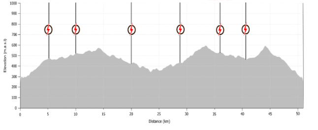
| Start | 290 a.s.l. |
| Highest point | 614 a.s.l. |
| Longest climb | 115 m (above Miðfellsháls) |
| Total climb | 1,250 m |
Information
Transponder timing
We use transponder timing in the 50 km race. We open the gates at 08:00 and everyone who wants can start their race then. The gates will be left open after that for an hour and the electronic chip will make sure to only register the time you actually spend in the course.
Getting to and from the mountain
We don't have enough space for private cars at the start, so we provide buses back and forth.
Clothes bags
You can leave your clothes in the start area in a bag similar to this we sell . The bags are kept outside, so make sure they are weather proof. You get a number to mark the bag with.
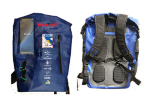
Everyone carries a backpack
We can face all weathers and anything can happen. For safety, participants in 25 km and 50 km races on Saturday are required to carry a backpack. We don't allow waist packs.
The backpack should at least include outer pants, a jacket, a cap and gloves. In addition, most bring some nutrition, a cup or a flask (we do provide drinks along the way but not cups), ski wax and phone. The bag should weigh at least 1,5 kg. Staff can weigh bags any time during the race. If it is too light or some of the requirements are not fulfilled, we add 15 minutes to your time. You can buy a bag in our web store..
Time limit
We have a time limit for the 50 km walk. A competitor must pass the drinking station on Heiðin (approx. 10 km) by 10:00 AM (based on a start time between 08:00–08:30) and then back to the same station on Heiðin after approx. 35 km (before 14:00 based on a start time of 08:00–08:30). Anyone who misses the time cut-offs will be stopped at these checkpoints and transported to the finish at Seljalandsdal.
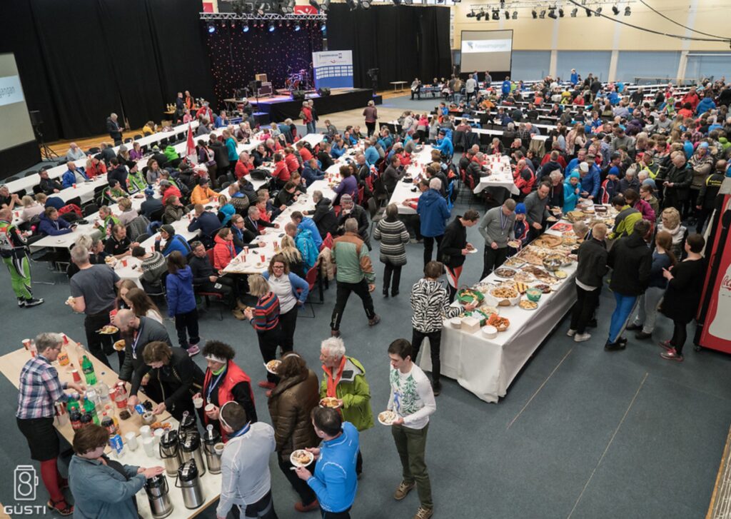
Cake buffet and prize ceremony
A generous cake buffet is held in the Torfnes sports center from 15:00-17:00. It is included in the participation fee.
Awards for the top places in the men's and women's divisions are presented immediately after the walk, while age group awards are presented at the coffee buffet at approximately 3:30 PM.
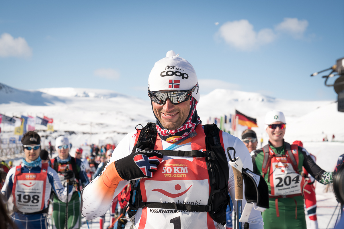
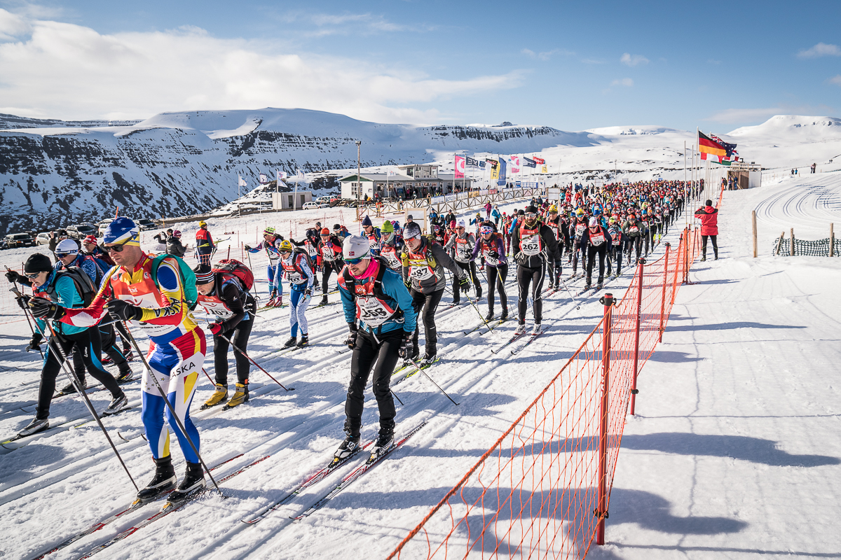
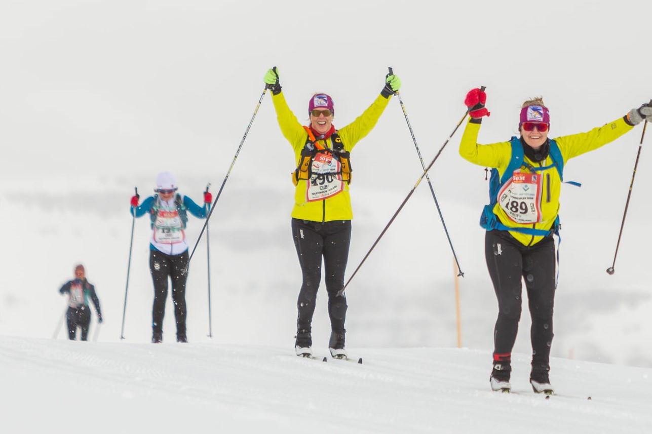
A few photos